General News
5 June, 2025
Grampians Rail Trail edges closer to Federation Park
LOCATED on the corner of Grampians Road and the Western Highway, Federation Park is the future location for the start of Grampians Rail Trail.
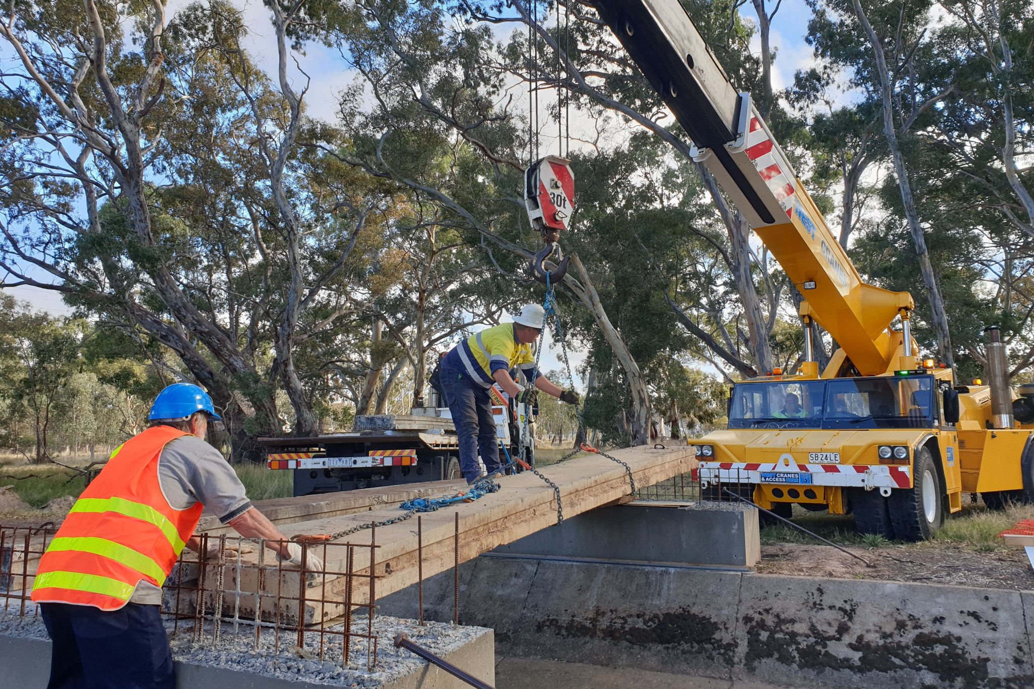
A bridge is under constructed over Pleasant Creek just south of Federation Park jointly funded by Stawell Gold Mines Community Fund and Bulgana Green Power Hub Community Fund.
The new bridge will allow the Grampians Rail Trail to begin at Federation Park which has toilets, barbeques and car parking.
This will also provide convenient access to recreational walkers and cyclist from Stawell.
Friends of Grampians Rail Trail are constructing the bridge with technical advice from Northern Grampians Shire and generous support from West Lift Cranes.
Project Co-ordinator John Pye said the project was a community effort.
“The support from Stawell residents and businesses demonstrates the value of the Grampians Rail Trail to the Stawell community. The theft of steel bar from the work-site was disappointing however the Northern Grampians Shire assisted with its replacement,” he said.
The Grampians Rail Trail follows the historic Heatherlie Rail Line that was used from 1882 to 1949 to transport sandstone from Heatherlie Quarry in the Grampians to Stawell, for historic buildings such as the Court House, and on to Melbourne for public buildings such as Parliament House and the State Library.
Grampians Rail Trail is 11km long and traverses forest, wetlands and creek environments and currently finishes on Mt Dryden Road near Lake Lonsdale.
The extension to Halls Gap is currently under consideration and will be an economic boom to hospitality businesses in Stawell.
The bridge will be completed during winter and track works will follow in spring.